"The thing that is important is to not underestimate the trail. There aren't
steep climbs but the trail is very technical, it wears on you over time so
don't underestimate it.” - Stuke Sowle
After my 50 miler in June I had several bigger that normal days in the mountains, a 17 mile in the Wasatch Steeplechase, 23 Mile trail run in the Alpine Lakes past Pratt Lake and a 22 mile trail run to Panorama Ridge in Canada. While in Europe on vacation I knocked off 2800 vert 11 mile loop of the Eiger trail and a 4000 vertical 12.5 run through the Dolomites. I came back home feeling strong and wanting to try something longer and more challenging.
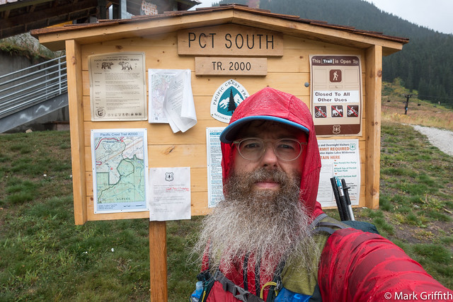
I set my sights on completing Section J of the PCT from Snoqualmie Pass to Stevens Pass, a distance of 75 miles and between 15000-19000 vertical feet. I wanted to complete it in a single push. When I looked at the "straight" line on the map and did the simple division it seemed 3.125 mph would put it at 24 hours. I spent a couple of weeks fretting and planning. Talking to Stuke Sowle several times who had done it twice before.
Why?
Before I begin, lets cover why? Why would I want to ultra-hike 75 miles in one push? First I love the mountains. They are my form of therapy. They are beauty. They are rugged. I go fast and I go light so that I get to see more. I get to cover more ground than I could otherwise. I have a busy life with family and job and spending less time going further and faster lets me get back home sooner and be with them.
Secondly I enjoy the challenge. To see what I can do, you know like the bear that went over the mountain? How far can I push it? What am I capable of? You only learn once you set out to achieve something, you can only plan and train so much before you are only going to learn by doing.
Having said that you shouldn't just get up off the couch and ultra-hike 75 miles. You can't do these types of activities without training and conditioning. Nor do you set out for this journey if you aren't well prepared and traveling as light as possible. You should have many long days in the mountains before attempting something like this. You should know how your body feels; what food and water needs you have over long days (more than 4 hours) in the mountains. You should be able to listen to your feet and make adjustments. You must travel light and have a sense of adventure and self reliance.
And the stark contrast of something difficult makes you appreciate the ease of our lives otherwise. I find when your on the journey the water never tastes sweeter and when your done the bed never felt softer or more of a welcome comfort.

Shane picked me up at my house on Thursday afternoon at 4pm. Traffic on I-90 sucked as they were still diverting to a single lane. He dropped me off around 5:30 pm. I turned on tracking on my Delorme, posted a link to FB for my wife and I set off up the trail. There were a lot of day hikers and a couple of trail runners coming down the trail. The sun was bright and warm as it started descending. As I got below Kendall Peak and turned the corner toward the Catwalk the wind picked up, the sunset was going off behind me and the darkness was coming on strong.

At the end of the Catwalk I stopped and put on my headlamp and started up the trail toward Joe and Alaska Lake. I was a little bummed to be doing this section of the trail in the dark as I'd never been on this section of the trail. I cruised through the talus fields below Chikamin and around and down to Park Lakes. From there the trail drops in earnest down toward Spectacle Lake, I listened to a lot of the Desert Discs podcasts that Stac had told me about the day before. I cruised through the burn and Lemah Meadows, here in the dark I saw two pair of eyes reflecting back from my headlamp. A little freaked out. I took out my Airpods, and made some noise and listened carefully for the next 1/2 mile or so. I then started climbing up the long switch backs toward Escondido Ridge. I was about 25 miles in, I'd been on the go for 8 hours and the time was approaching 3am. I was feeling a little tired, so I decided to lay down and sleep until daylight. I found a flat spot on the trail and rolled out my pad and bag. I set my wet sweaty shirts and shorts on the trees, pulled on my compression socks, put on my jacket and climbed into my bag. I was warm and comfy. I quickly feel asleep.

I had set my alarm for 6:00 am the next morning and when I woke up I felt really good. My legs felt great. I had a sandwich and I changed back into my dry clothes and set off. The morning view and the orange sky was spectacular. The jagged peaks of Lemah, Chimney and Overcoat cut a fetching line across the sky. As I topped the Escondido Ridge I stopped at the small tarn that I'd first visited over 13 years ago on my first backpacking trip in Washington. I set off through the Waptus Burn, the fireweed and the red huckleberry bushes.

Here I encountered my first hikers coming down north from Stevens Pass. I carried on and the sky was an awesome mottled set of clouds, light and Stuart way off in the distance.

Planning
I used Stuke’s route from Section J. The plan was to start at Snoqualmie Pass on I-90 and end at Stevens Pass on Highway 2. I identified all my bail out options should something go wrong :
- 15.5 miles : 25km : Park Lakes -> Mineral Creek
- 18.75 miles : 30km : Pete Lake -> Pete Lake Trail head
- 35 miles : 55km : Waptus Lake -> Cooper Lake
- 43 miles : 70km : Cathedral Rock -> Hyas Lake
- 56.2 90km : Surprise Lake -> Highway 2
I used https://darksky.net/ to look at weather predictions. I had 3 Fridays off and the forecast for my date on 10/6 kept getting worse as the rain began creeping toward Friday. I decided to leave Thursday evening after work. I got Blake Barlow to agree to drop my truck off at Stevens Pass and I arranged for Shane Reckling to drop me off at Snoqualmie Pass. I hoped to finish sometime Friday night.
My Packing List
This trip would be solo and unsupported. I had invited Shon Hancock to accompany me but he had family duties to attend to. My list of what I took :
- Pack
- Ultimate Direction Fastpack 20
- Exped SynMat HL Sleeping Pad (.95 lbs)
- Western Mountaineering SummerLite 32 Degree Sleeping Bag (1.18 lbs)
- Bivvy sack & 10 Essentials pack
- Blister pack
- Clothes
- Patagonia Ultralight Down Jacket
- Patagonia Houdini Light shell
- Patagonia Houdini Pants
- Lightweight Gloves
- Patagonia Beanie
- Territory Run Co. Loowit Athletic Trucker Hat
- OR Sleeves
- Compression socks
- Patagonia Shorts
- OR short sleeve T-shirt
- Darn Tough Wool Socks (2 pairs)
- Salomon Sense Pro Max Trail Running Shoe
- Glide (anti-chafe)
- Black Diamond Z-Poles
- Black Diamond Storm light 135 lumen
- Z-Sit Pad
- Two Salomon flasks
- An extra camelback flask
- Electronics
- Iphone 7+ with Moment Case
- Gaia App on phone with Section J map loaded
- Apple Airpods
- Sony RX100V Camera
- Super Wide angle Moment lens
- Garmin Feenix 3 watch
- GoPro Session
- Anker Charger
- iPhone Cable (should have brought cable for watch and for camera)
- DeLorme inReach SE Satellite Tracker
- Food
- 4 packs of caffienated jelly beans
- Peanut Butter and Honey (2)
- Honey crisp apple (2)
- Justins Almond Maple Peanut Butter packs
- Numerous bars and gels
My pack weighed around 20 lbs all loaded up with water and food. The Fastpack was super duper comfy and light - much much lighter than backpacking, but it didn’t have a hip belt. I ran a couple of times with it on and it was a bit too bouncy for my tastes. For a phone I had the iPhone 7+. I don’t like how big it is but the size gives it a bigger battery and better radio signal (once when I got benighted on top of Stuart with Adrian his 6+ could make a call out and my smaller 6 couldn’t). I had audio books, music and a ton of podcasts loaded to keep my occupied. I use the Gaia app on my phone for route finding, it lets you pre-load maps and routes and with the GPS from phone I can check in on where I am at and if I am off route. I took an Anker portable charger and a cable for my phone. Should have also taken a micro usb mini cord for my Delorme SEND which ran low on battery and I turned off tracking. I wore the Garmin Fenix 3 instead of my Apple Watch because of the battery life. Just before I left I put it in lower power mode GPS tracking called Ultratrac, this would come back to bite me in the middle of the night.
I slept in the compression socks I slept in them, not sure if they helped but my legs felt really good when I got up. I decided to start out the day in them but quickly switched back to the Darn Tough wool socks as they were too slippy and I was getting hot spots.
The Route
At the end of the Catwalk I stopped and put on my headlamp and started up the trail toward Joe and Alaska Lake. I was a little bummed to be doing this section of the trail in the dark as I'd never been on this section of the trail. I cruised through the talus fields below Chikamin and around and down to Park Lakes. From there the trail drops in earnest down toward Spectacle Lake, I listened to a lot of the Desert Discs podcasts that Stac had told me about the day before. I cruised through the burn and Lemah Meadows, here in the dark I saw two pair of eyes reflecting back from my headlamp. A little freaked out. I took out my Airpods, and made some noise and listened carefully for the next 1/2 mile or so. I then started climbing up the long switch backs toward Escondido Ridge. I was about 25 miles in, I'd been on the go for 8 hours and the time was approaching 3am. I was feeling a little tired, so I decided to lay down and sleep until daylight. I found a flat spot on the trail and rolled out my pad and bag. I set my wet sweaty shirts and shorts on the trees, pulled on my compression socks, put on my jacket and climbed into my bag. I was warm and comfy. I quickly feel asleep.
I had set my alarm for 6:00 am the next morning and when I woke up I felt really good. My legs felt great. I had a sandwich and I changed back into my dry clothes and set off. The morning view and the orange sky was spectacular. The jagged peaks of Lemah, Chimney and Overcoat cut a fetching line across the sky. As I topped the Escondido Ridge I stopped at the small tarn that I'd first visited over 13 years ago on my first backpacking trip in Washington. I set off through the Waptus Burn, the fireweed and the red huckleberry bushes.
Here I encountered my first hikers coming down north from Stevens Pass. I carried on and the sky was an awesome mottled set of clouds, light and Stuart way off in the distance.
I cruised along the top of the ridge and had a view of Bears Breast and Waptus Lake lay far down below me in the valley. Waptus is over 1.5 miles long and one of the largest lakes in the Alpine Lakes Wilderness. Dropping down and getting around the lake takes a long time. The trail winds slowly down and then adjacent to the lake.

I stopped at the eastern end of the lake and sat on a log and ate an apple and admired the view looking down the lake at Bears Breast. There was a bit of rain following as the clouds blew through.

I set off up the valley toward Deep Lake, a place I'd only seen from high above near Cathedral Rock. I ran into another thru-hiker who was heading from Snoqualmie to Stevens, we chatted for just a second before I pushed on. I detoured to Deep Lake among the vibrant yellow fall grass and the red huckleberry bushes to take a couple of photos and then started the climb up the ridge to Cathedral Rock. In the beautiful meadow I carried on toward Deception Pass. The day was fading and darkness was coming on.
At 5 pm, I sent a message on my Delorme to my wife :
At this time I was actually at 61.25 miles, and I actually had 13.75 miles left. I had been dreaming at of a hamburger and a warm bed since 7 pm when I though I only had 3 hours left. I had misread the trail sign and I had turned north (left) and dropped 400 feet down the Tunnel Creek Trail. As the trail grew more narrow and rougher I knew I was on the wrong trail. I opened Gaia to find I had to reclimb back up to the PCT. Now staring at the map in earnest I realized I had a hill to climb. It was 2 am and I was beat not just physically but mentally. I didn't have it in my willpower to climb the hill.
I was at mile 62.5, I had 12.5 miles left. Near Mig Lake I found another flat place on the trail near a large tree. I hoped the canopy of the tree would give me a little protection from the rain. I pulled out my pad and bag and climbed in them and feel asleep again.

I woke the next morning at 6:30 with my bag wet but I was warm and rested. I was physically tired but my feet didn't hurt. Just at this point I didn't much care. I just wanted to be done. I didn't eat any food from this point on because I knew the end was coming and I was holding out for a hot meal. I was just in the shuffle ahead mode, though the fog made for eery conditions.
Sadly the trail kept climbing one ridge after another. I thought I had made the final ascent at least 3 times before I finally saw the last ridge with the ski chair above Stevens Pass. I topped out on the ridge with the wind blowing strong. And then made my way down the switch backs among the ski lifts until I finally arrived at the lodge and the end of the trail. My 75 miles read 96 on my watch. As I dropped into cell territory, Shon Hancock texted me asking me where I was at, appreciated him checking in on me. I could smell food at the lodge but a worker outside said the breakfast was only so so and I wanted something really good. I made my way across the walkway over Highway 2 to my truck where I dropped my pack on floor of the front seat and took a big swig from the water bottles in the back.

Rain was falling in earnest as I made my way down the pass and stopped in at Skykomish at the Cascadia Inn. I was wet and shivering as I sat in the corner at a table. I ordered biscuits and gravy, with two eggs over easy and a side of sausage which I threw on top. The warm food tasted wonderful. Driving home from Steven’s Pass I was so tired I had to keep pinching my legs, singing as loud as I could to stay awake. I feel asleep at a stop light for a second. I lay down and took a two hour nap. That night I slept for 12 hours.
I set off up the valley toward Deep Lake, a place I'd only seen from high above near Cathedral Rock. I ran into another thru-hiker who was heading from Snoqualmie to Stevens, we chatted for just a second before I pushed on. I detoured to Deep Lake among the vibrant yellow fall grass and the red huckleberry bushes to take a couple of photos and then started the climb up the ridge to Cathedral Rock. In the beautiful meadow I carried on toward Deception Pass. The day was fading and darkness was coming on.
At 5 pm, I sent a message on my Delorme to my wife :
Turning off to save battery.
At mile 61.5. 14 more to go.
Talk to you later love you.The only problem was that my watch was wrong. Instead of being at mile 61, I was actually at 46.25 miles. Just before setting out on Thursday afternoon I had changed my watch to Ultratrac mode to save battery. The problem was that after I got home and attempted to see what had gone wrong I read that you needed to do several runs with Ultratrac to calibrate since it used the accelerometer along with intermittent GPS sampling to save battery. No calibration period meant that the watch was overestimate my distance. This would cause me serious mental expectation issues.
9:48pm
Talk to you later love you.
Have at least 7 more miles.
Watch was wrong.
At least 90-120 more minutes.
I was actually at mile 57, actually had 18 more miles! And since I thought I was so close I didn't really bother to read the map on Gaia very closely and I kept thinking that the remaining trail was all downhill.
12:48 am
Wow. This trail is so long.
Going slow because tired.
Probably 2 more hours.
At this time I was actually at 61.25 miles, and I actually had 13.75 miles left. I had been dreaming at of a hamburger and a warm bed since 7 pm when I though I only had 3 hours left. I had misread the trail sign and I had turned north (left) and dropped 400 feet down the Tunnel Creek Trail. As the trail grew more narrow and rougher I knew I was on the wrong trail. I opened Gaia to find I had to reclimb back up to the PCT. Now staring at the map in earnest I realized I had a hill to climb. It was 2 am and I was beat not just physically but mentally. I didn't have it in my willpower to climb the hill.
2:18 am
Ok. Going to sleep in trail.
Will finish in the am.
Too tired. Love you.
Good night.
I woke the next morning at 6:30 with my bag wet but I was warm and rested. I was physically tired but my feet didn't hurt. Just at this point I didn't much care. I just wanted to be done. I didn't eat any food from this point on because I knew the end was coming and I was holding out for a hot meal. I was just in the shuffle ahead mode, though the fog made for eery conditions.
Sadly the trail kept climbing one ridge after another. I thought I had made the final ascent at least 3 times before I finally saw the last ridge with the ski chair above Stevens Pass. I topped out on the ridge with the wind blowing strong. And then made my way down the switch backs among the ski lifts until I finally arrived at the lodge and the end of the trail. My 75 miles read 96 on my watch. As I dropped into cell territory, Shon Hancock texted me asking me where I was at, appreciated him checking in on me. I could smell food at the lodge but a worker outside said the breakfast was only so so and I wanted something really good. I made my way across the walkway over Highway 2 to my truck where I dropped my pack on floor of the front seat and took a big swig from the water bottles in the back.

Rain was falling in earnest as I made my way down the pass and stopped in at Skykomish at the Cascadia Inn. I was wet and shivering as I sat in the corner at a table. I ordered biscuits and gravy, with two eggs over easy and a side of sausage which I threw on top. The warm food tasted wonderful. Driving home from Steven’s Pass I was so tired I had to keep pinching my legs, singing as loud as I could to stay awake. I feel asleep at a stop light for a second. I lay down and took a two hour nap. That night I slept for 12 hours.
Stats
Started : Thursday, September 28, 2017 at 5:30:00 pm
Ended : Saturday, September 30, 2017 at 10:30:00 am
Result: 1 day, 17 hours, 41 hours total. Moving hours 32, sleeping 7 the rest taking a break or setting up/breaking down "camp."
Result: 1 day, 17 hours, 41 hours total. Moving hours 32, sleeping 7 the rest taking a break or setting up/breaking down "camp."
- 172,178 steps
- 75 miles
- 17433 calories burned
- Elevation : 15k
Calories consumed : 4110
- 3 : Gold Stingers : 100 calories
- 2 : Kind PB Dark Chocolate : 200 calories
- 1 : Kind Apricot Pear Carrot Beet : 110 calories
- 2 : Extreme Sport Beans Watermelon Flavor (caffeine) : 100 calories
- 2 : Extreme Sport Beans Assorted Flavors (caffeine) : 100 calories
- 1 : Chocolate outrage Gu ; 100 calories
- 1 : Mocha Latte Coffee Bar : 190 calories
- 1 : Little Buddys Nut Butter : Honey Peanut : 180
- 2 : Honey Crisp apples : ?
- 2 : PB & J : ?
- 6 : Justin’s PBs (variety flavors) : 190 calories
- 1 : Cliff Builders Protein Bar : Crunchy Peanut Butter : 90 calories
- 1 : Honey Stinger Waffle, Wildflower Honey : 140 calories
Afterwards
I rested all week but it hurt to walk. My left foot, the second to last and middle toe felt strained and a bit “tingly” or nerve tweaked. My achilles heel on my right foot hurt to walk with every step until the following Wednesday. Thursday felt better and I felt no pain by Friday. Saturday I went for a 6.5 mile 2800 vertical feet trail run on Tiger. I felt fine but my legs felt sluggish and my left foot felt a tad bit re-aggravated on the same two toes. Two weeks later I took Friday off and I went for a 15 mile trail run on Cougar and my left foot felt re-tweaked and my two toes were bothering me again. I had to change my gate. The impact of the trip lasted much longer on me than I thought it would and I am planning on just hiking it out for the next 2 weeks to let me feet rest.
I am looking forward to my next epic, maybe a hundred. Maybe here on my local Issaquah Alps with some food drops and shoe changes in between. Next year I definitely want to do the Wonderland in one push. Just have to wait for the snow to melt! :)
All the photos and the video vlog of the trip.
I am looking forward to my next epic, maybe a hundred. Maybe here on my local Issaquah Alps with some food drops and shoe changes in between. Next year I definitely want to do the Wonderland in one push. Just have to wait for the snow to melt! :)
All the photos and the video vlog of the trip.