
Mark Griffith
Mark Griffith
Explorer & Creator
niffgurd.com | Blog

Dutch Miller Gap — October 29, 2005

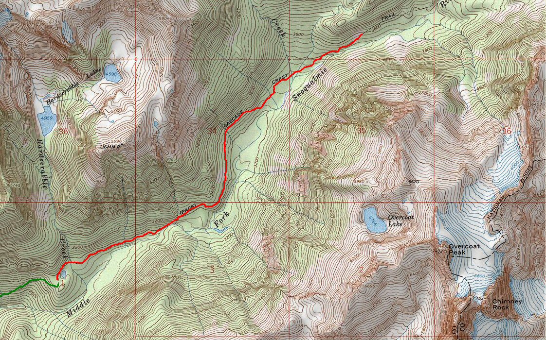
Dutch Miller Gap Oct 29th 2005

Location: Alpine Lakes Wilderness in Washington

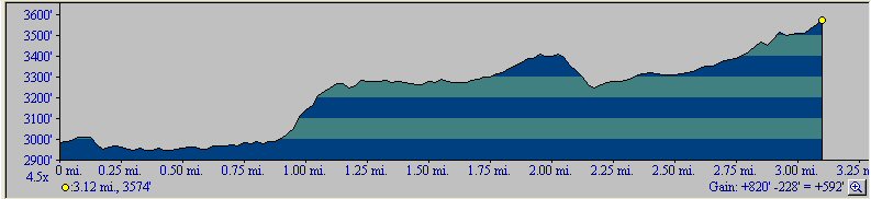
Elevation: 820 feet

Length: 6-mile round-trip

Trail Head :

25.6 miles from I-90. From Seattle take I-90 East to Exit 34. Turn left at the stop sign. In 0.6 mile turn right onto SE Middle Fork Road (#56). Continue for 12.2 miles (gravel road starts in 2.5 miles) to the junction after bridge crossing. Take the road to DutchMiller Gap continue for 13.4 miles. There are two forks in the road, always take the left higher road. The road is very rough, you'll need at least 90 minutes to get to the trail head. Overview
Photos on Flickr

#flickr_badge_source_txt {padding:0; font: 11px Arial, Helvetica, Sans serif; color:#666666;} #flickr_badge_icon {display:block !important; margin:0 !important; border: 1px solid rgb(0, 0, 0) !important;} #flickr_icon_td {padding:0 5px 0 0 !important;} .flickr_badge_image {text-align:center !important;} .flickr_badge_image img {border: 1px solid black !important;} #flickr_www {display:block; padding:0 10px 0 10px !important; font: 11px Arial, Helvetica, Sans serif !important; color:#3993ff !important;} #flickr_badge_uber_wrapper a:hover, #flickr_badge_uber_wrapper a:link, #flickr_badge_uber_wrapper a:active, #flickr_badge_uber_wrapper a:visited {text-decoration:none !important; background:inherit !important;color:#3993ff;} #flickr_badge_wrapper {background-color:#ffffff;border: solid 1px #000000} #flickr_badge_source {padding:0 !important; font: 11px Arial, Helvetica, Sans serif !important; color:#666666 !important;}