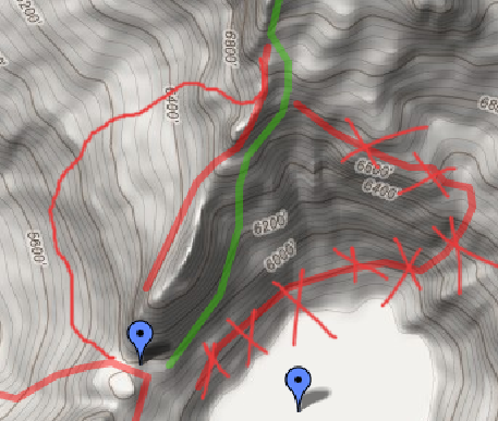
The lower lake is where the little brown outline is in the lower right corner there. Run directly west of there and descend left until you're past the steep stuff and can easily traverse right.

Here's the proposed route up the ridge to the west and the boot trail up the gully to the gap (which isn't located where it's marked on the map).
Here's a line showing the ramp I'm talking about at 6000' and the route across the top of Hinman.
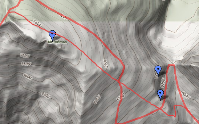
Wrong side of the rib.The whole bowl above Venus is cliffy. And you don't cross the ridgeline back to the right until you hit 6800'. Running the ridgeline's not reasonable.